New article first published online: Environment and Planning B: Urban Analytics and City Science; DOI: 10.1177/2399808320938803
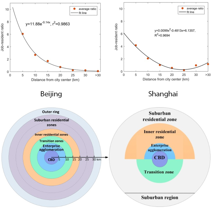
ABSTRACT: The jobs–housing balance and urban spatial structure are naturally connected, and understanding the connection is important for urban planning, geography, and transport studies. Using smartcard data in Beijing and Shanghai, this research employs a comparative approach to reveal spatial distribution patterns of jobs–housing balance in terms of transit commuters and derive the implied urban spatial structures for the two megacities in China. Results suggested that (1) the overall job–resident ratios estimated with smartcard data were 1.97 and 2.47 in Shanghai and Beijing, respectively; (2) compared to Beijing, Shanghai had greater intermixing of jobs and housing; (3) Beijing’s urban form followed a concentric spatial structure, whereas Shanghai followed a quasi-sector configuration. These findings show that the job–resident ratio can be used as an indicator to capture land-use patterns or functional zones, which is useful for urban planning and transit network design.
Read the full publication at Environment and Planning B: Urban Analytics and City Science
Read the preprint pdf at ResearchGate